

 Imagine you have been looking out of the window of the airplane and spotted a beautiful place - and you would like to know where that was.
If you don't have your GPS-receiver with you to hold it to the window to mark the location (or no internet connection in the airplane) you have the chance to just remember the time. When you have access to the internet again you check gmapsflighttracker.com to locate your flight and move to the time where your flight was at that position.
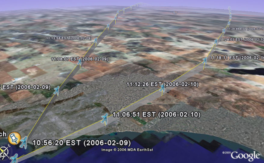
In addition we offer Google Earth support for these airplane traces. Just right-click the "Download GE kml"-Link, save the file to disk and fire up Google Earth to display past flights including height profiles!
The new version shows a beta preview of this feature for some selected flights to Boston.
Above is a screenshot of GE showing flights of AAL222 in Google Earth near Los Angeles.
Misc additions:
- Cheapest Fare information. Click on a flight in the menu on the left to show information about cheap fares for the selected flight. You have to enable this service in the "controls". Using data provided by http://www.farecompare.com/
- Support for zooming the map using the mouse scroll wheel
- Tracking of a flight (small "T") leaves a trace of the flight
- Nexrad support. Shows present precipitation. We are working on showing the flight locations more visible when using the Nexrad type. Using data provided by the Iowa State University Department of Agronomy. More Information about Nexrad is here
1 comment:
Hi Dear, Nice article, useful information.. i too did some research found some more cool mashups, thought of sharing to all the readers..
http://askwiki.blogspot.com/2010/01/tracking-flights-on-google-map-real.html
Post a Comment